Nyamuragira, also known as Nyamulagira, is an active shield volcano in the Virunga Mountains of the Democratic Republic of the Congo, situated about 25 kilometres (16 mi) north of Lake Kivu. The name is derived from the Bantu verb Kuragira nyamu, meaning to herd animals; nyamu means animal or cows.

Nyamulagira
It has been described as Africa’s most active volcano and has erupted over 40 times since 1885. As well as eruptions from the summit, there have been numerous eruptions from the flanks of the volcano, creating new smaller volcanoes that have lasted only for a short time (e.g. Murara from late 1976 to 1977).

nyamuragira_volcano
Nyamuragira volcano is an active volcano near the city of Goma in the Democratic Republic of the Congo, situated about 25 kilometres (16 mi) north of Lake Kivu. It is in the Nord-Kivu Province. It is 13 kilometres (8.1 mi) north-north-west of Nyiragongo, the volcano which caused extensive damage to the city of Goma in its 2002 eruption.
Nyamuragira has a volume of 500 cubic kilometres (120 cu mi), and covers an area of 1,500 square kilometres (580 sq mi). It has a low shield profile and contrasts with adjacent steep-sided Nyiragongo volcano.

Sulfur dioxide emissions by volcanoes, 1979-2003.
Nyamuragira volcano is responsible for a large portion of the sulfur dioxide released into the atmosphere by volcanoes.

Lava flows from Nyamuragira (upper left) extend to Lake Kivu.
2010 eruption
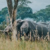
At dawn on 2 January 2010 Nyamuragira began spewing out lava flows. There are no settlements close to the volcano, but wildlife officials feared that the eruption may threaten the chimpanzees in the area. Another danger was that the lava could have flowed into the southern sector of Virunga National Park, where there are settlements and villages.
Extensive lava flows from the 2010 eruption can be seen on satellite photographs reaching 25 kilometres (16 mi) south-west to Lake Kivu, about 22 kilometres (14 mi) north-west and 35 kilometres (22 mi) north-north-east.
2011 eruption
The volcano erupted again on 5 November 2011.
That eruption produced a 400-metre (1,300 ft) high column of lava, and it is said to have been its largest eruption in 100 years.
2014 lava lake
.jpg)
Part of crater of Nyamuragira volcano
2021 lava lake
In 2021, a lava lake appeared at the volcano based on a June
for more details visit: