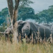

Lake Albert is shared between Uganda and the Democratic Republic of Congo (DRC). The lake’s water is mainly controlled by the Nile River. Population density in some parts of the lake basin is as high as 149 people/km2. The population growth rate is also quite high. Many people around the lake lack access to clean drinking water, improved sanitation and improved health facilities. This results in a high prevalence of HIV/AIDS and water related diseases. Lake Albert has a lower fish diversity than other African Great Lakes, but a high fish catch and dependence on fishing for livelihoods. The area around the lake also supports small, subsistence farming. The basin’s natural biodiversity and proximity to parks make it important for tourism. Oil and mineral extraction are a possibility in the basin.

Lake Albert is located in the Western Rift Valley at an altitude of 615 meters above sea level. The lake is shared between Uganda (46%) and Democratic Republic of Congo (DRC) (54%). The lake was formed about 10-12 million years ago. It is about 60 km long and 30 km wide, with a surface area of 5,300 km2. It has a shoreline length of 508 km, an average depth of 25 m and maximum depth of 58 m, a water volume of 280 km 3 and a basin area of 17,000 km2. The primary rivers flowing into the lake are the Semliki River from Lake Edward and the Victoria Nile from Lake Victoria through Lake Kyoga. The Albert Nile flows out of the lake. Most of the lake’s water is carried in by the rivers.
For more information visit